
The last time I hiked Point Mountain was July of 2014; I really enjoyed the hike and have wondered if the views from the ridge would be any better when the trees were barren and leafless. I decided to make my way back last weekend to hit the ridge before spring really set in.
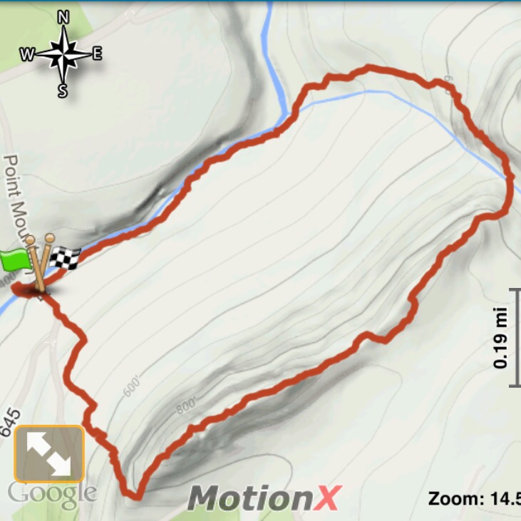 I followed the same route I took last time, parking on Point Mountain Road; hitting the trail right by the bridge that crosses the Musconetcong River. I took the blue trail through the fields, then followed the orange trail to the ridge.


Hike 11 stats:
Date: March 26, 2016
Weather: 50°F, sunny
Location: Musconetcong River Reservation – Point Mountain Section
Distance: 2.89 miles
Time: 1:40
Total Ascent: 688′
Highest Elevation: 964′
Highlights: cliff views, river banks
Park Map: Point Mountain Central and South Section Map


The views from the top were as great as I had remembered, and yes, you could see a little bit more without the tree cover.

Point Mountain Ridge
The Point Mountain hike is considered a moderate hike due to the steep rocky ascent. I’d say that the hike, overall, is easy to moderate and is a good starter hike if you’re just getting interested in more difficult hikes. The challenges are there, but they’re short and manageable for less experienced hikers.


Great pictures. I was on Point Mountain a few days before. We are bound to run into each other at some point during our 52 hike challenges, right?! Lol I’m hiking #26 next week :)
Have fun!
Awesome! I just did #14 this morning :)